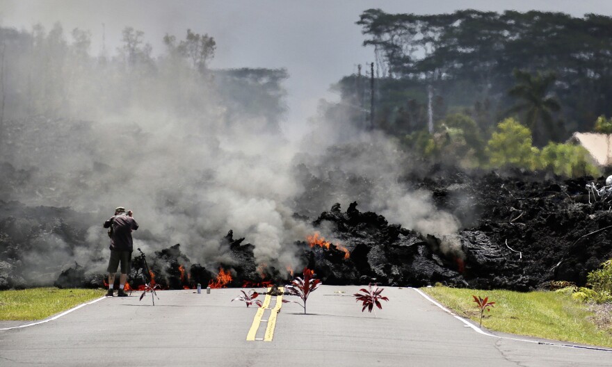
It's been five years since the 2018 Kīlauea East Rift Zone eruption destroyed over 700 homes, displaced 2,000 people and created 875 acres of new land.
Twenty-four fissures opened up and spewed lava that covered nearly 14 square miles from the Leilani Estates subdivision down to Kapoho Bay. In some places, lava is over 200 feet deep — and still cooling.
Talmadge Magno, the Hawai‘i County civil defense administrator, remembers monitoring the volcano in the days leading up.
"The residents knew it, they felt the shaking. There was hundreds of earthquakes that they could just feel the tremor as the magma moved into the area," Magno said. "We knew once we started seeing gases, there was a high likelihood that magma would be coming soon."

Puna residents can look forward to restoration for most of the roads overrun by lava. Magno said the plan is to reestablish the majority of the roads in the stretch of land from Leilani Estates to Pohoiki to Kapoho Bay.
The county is not planning to establish a public viewing area of the lava from the eruption.
"The current situation now is it's all private land. So we respect people's private property. I know there was trespassing issues early on — it continues. But the county does not, we're not planning any viewing areas," Magno told HPR.

"Just by driving around the areas just along the highways, Highway 132, you go right through the flow field, you drive right through the river, the flow channel that Fissure 8 created basically, and you can see all these features just by driving on the public roads," Magno said.
The county buyout program for people who lost their homes continues to work through applications. Nearly $50 million has already been disbursed, according to the county.
This interview aired on The Conversation on May 17, 2023. The Conversation airs weekdays at 11 a.m. on HPR-1.


