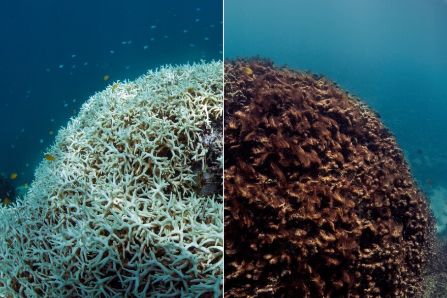
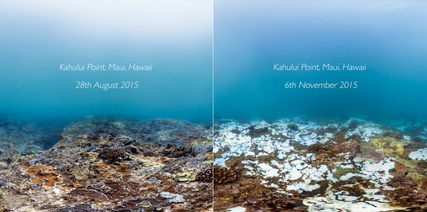
The bigger picture surrounding the state of our reefs just became a bit clearer. New technology and imaging data are helping scientists quickly survey coral reefs from around the world. HPR’s Molly Solomon has more.
Equipped with a 360-degree underwater camera and three powerful processing units, a collaborative research project has become a coral data goldmine.

University of Queensland professor Ove Hoegh-Guldberg is the lead scientist on the project which partnered with the UC Berkeley Artificial Intelligence Research Center to create the XL Catlin Global Reef Record. Hoegh-Guldberg says the team spent the past four years capturing hundreds of thousands of images of coral reefs from 26 different countries.
“Every dive we’re coming up with 1,000 images. We take those 1,000 images and train computers to tell us what’s in those photos,” explained Hoegh-Guldberg. “That’s really crucial as we try to understand whether corals are disappearing, are other organisms appearing, disease, and a whole series of things that we feel now we have computers trained to spot.”
The new technology can process data 900 times faster than previous methods and is capable of analyzing as many as 90 images a minute. Part of what speeds up the process is facial recognition software that can identify everything from the type of coral in the photo to mortality rates from coral bleaching.
“Being able to do that and go through with the computer spotting the bleached areas, you find that they’re much better than a human,” said Hoegh-Guldberg. “They can do so much more in one dive.”
“This is a real game changer to be able to do that much so quickly and automatically,” said Mark Eakin, the coordinator of NOAA’s Coral Reef Watch. He recently announced the current global coral bleaching event will continue this summer, stretching into its third straight year. He says this new technology and imaging is critical for creating baseline data and documenting coral reefs around the world.

“Many places, this bleaching event has been the worst that’s ever been seen,” he said. “[XL Catlin] is another group that’s able to provide a lot of this information to assess how bad the impact will actually be.”
The new tool is especially useful for scientists, who can use the survey’s findings to gain a more comprehensive picture of coral disease. Ruth Gates is the president of the International Society for Reef Studies and director of UH M?noa’s Hawaii Institute of Marine Biology.
“This allows us to understand how the reef varies over space, how quickly it changes over time, and how reef is influenced by different things,” said Gates. “It’s an amazing record.”

The coral database not only serves the scientific community, it’s also free and available to the public, says lead project researcher Ove Hoegh-Guldberg.
“We’re bringing people on the science journey,” he said. “We need to bring these types of narratives about climate change to people where they can have a look themselves and really understand what’s happening to these rainforests of the sea.”
The XL Catlin Global Reef Record was announced at this week’s International Coral Reef Symposium in Honolulu.


