Experts agree that severe weather events are becoming more frequent and destructive as the planet warms. But so far there is little consensus on how to protect one of Hawaii’s most important economic regions.
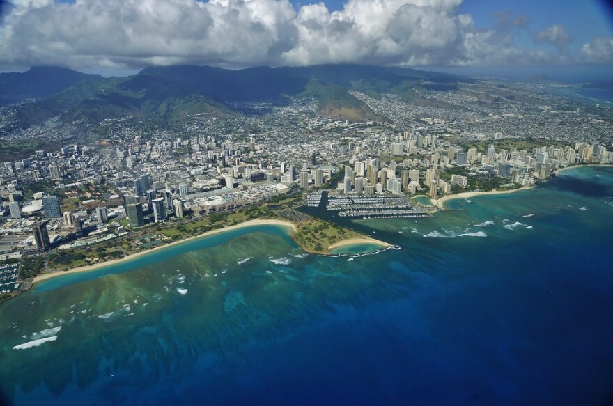
The Ala Wai watershed encompasses a lot more than the eponymous canal. It stretches from Palolo Valley to Makiki, and includes the Ewa-facing slopes of Diamond Head, three major streams and a dozen smaller tributaries.
A drop of water deposited anywhere in that area, unobstructed, will flow toward the Ala Wai Canal, where it drains out to the ocean.
That dynamic is precisely what creates a major flood risk. Under normal or even above-average rain conditions, natural and artificial drainage features direct water away from developed areas where it could cause damage.
But climate change-fueled storms are now at risk of overwhelming that system.
As the atmosphere warms, it is able to hold more water vapor. That means when storms form, they can deposit a higher volume of water in the form of rain. We saw this at work during the 2018 “rain bomb” floods in Hanalei and Aina Haina.
At just under 50 inches of rain, the Hanalei event set the current record for highest 24-hour rainfall total in the United States. It caused an estimated $125 million in damage.
Such an event would cause over $1 billion worth of destruction in the Ala Wai watershed — home to the state’s economic engine, Waikiki. That damage estimate comes from the U.S. Army Corps of Engineers, the federal agency charged with managing the nation’s waterways.
The Corps, or USACE, wants to protect the lower Ala Wai Watershed, which includes Waikiki, McCully-Mo’ili’ili and parts of Ala Moana, by constructing a series of basins to catch rainwater during a storm event and release it slowly over time.
The system would also include flood barriers along the actual Ala Wai Canal, which is expected to overtop its current walls during a high-rain event.
Jeff Herzog, who is overseeing the project for the USACE Honolulu District, says the project is designed to protect the neighborhoods of the watershed from a 100-year storm.
“What we’ve found is that the bottom of the bowl per se is the McCully-Mo’ili’ili area. That’s the highest risk,” Herzog said.
The estimated cost of the project is almost half a billion dollars, with $345 million coming from the federal government. The remainder of the construction and maintenance costs would be borne locally. Currently, the state is slated to front the remaining $125 million for construction, while the City and County of Honolulu would assume on-going maintenance costs.
The flood control project is an early example of the massive investment that will be needed to protect existing communities and infrastructure from climate change. But past human development has worsened the problem, according to Josh Stanbro, chief resiliency officer for the city.
“The irony is as the project came about because the entire watershed has been hardened. So whether its driveways or streets or hardened streams, that water doesn't soak in any longer,” Stanbro said.
That effect, coupled with the increasing frequency of destructive storms, is putting pressure on policy makers to act preemptively. Not everyone in the community agrees with the current direction.
Sidney Lynch, a longtime resident of Palolo, opposes the Corps' current design. She founded Protect Our Ala Wai Watershed, a group that is suing the city and state over their support for the Ala Wai Flood Control Project.
The Corps has already signaled that it intends to walk back some of the more controversial aspects of the plan, but Lynch and many others in the community remain skeptical.
“You feel so powerless because nobody's listening and they dismiss you as a NIMBY. I'm not a NIMBY. They’re not taking my property, but I will be living with the effects of this,” Lynch said.
Three city lawmakers representing the neighbors in the Ala Wai watershed appear to share that skepticism. They approved $100,000 for a contract with Honolulu-based design firm Oceanit to explore alternative options.
Patrick Sullivan, a professional engineer and the firm’s founder, has taken a notably different tack than the Corps of Engineers. He champions a problem-solving technique called “design thinking,” which lists “empathize” as step one.
Rather than creating a design and then presenting it to the community, Sullivan didn’t even bring his engineers to initial community meetings. Instead, he plans on spending at least six months listening to public concerns before proceeding with a plan.
“By listening, you create a safe place for people to share what they think and how they feel. That's got to get distilled and synthesized, but it's got to start with active listening,” he said.
Sullivan, who holds a doctorate in electrical engineering, was clear that he does not think there was any ill intent on the part of federal planners at the Corps of Engineers. In fact, he told community members that it’s possible Oceanit may end up making a similar recommendation. But he hopes that his approach will create community buy-in for whatever option the Corps implements.
The project illustrates the central challenge of climate adaptation: how do policy makers decide who to impact when trying to reduce risk? A flood control system in the Ala Wai watershed stands to affect at least half a dozen densely populated neighborhoods, hundreds of businesses, and groups from property owners to recreational canoe paddlers.
Oceanit chief Sullivan says tackling these kinds of problems will require a new way of thinking.
“The way these projects get introduced and the way they get solved will have to evolve, because this is a problem we’re going to be living with in the modern world.”


